1693
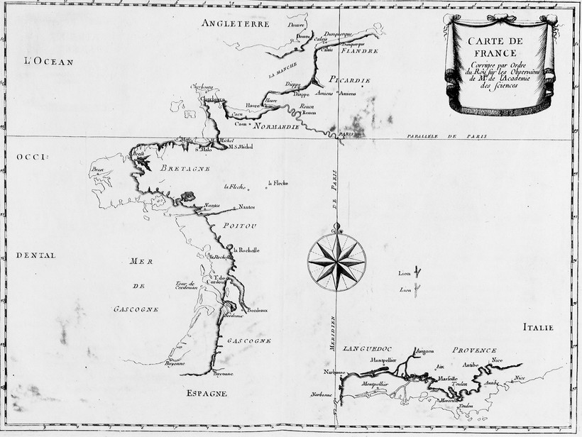
Astronomers correct the map of France
From 1676 to 1681, the Academy of Sciences sent Picard (1620-1682) and Philippe de la Hire (1640-1718) to determine the geographical coordinates of various French ports. They used the new method of eclipses of the Jovian satellites to find the longitudes. This method was much better than what had been used previously, and they found errors in the latitudes, which they remeasured. Some considerable time after their return, La Hire published the Map of France, corrected using this data. It turned out that France had lost a tenth of its width, and a small part of its height, so that “the King proclaimed, jokingly, that their trip had only led to losses.”
caption : The new map of France - copyright : Observatoire de Paris
